
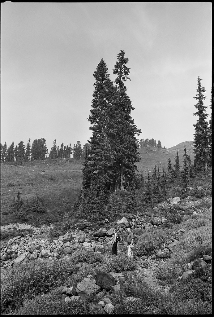
Hiking on the Scott-Paul trail in the Mt. Baker area of WA with some friends. I miss summer already.
GSW690III, 400TMY
Scott-Paul Trail Hike by tuco, on Flickr
Scott-Paul Trail Hike by tuco, on Flickr


Hiking on the Scott-Paul trail in the Mt. Baker area of WA with some friends. I miss summer already.
GSW690III, 400TMY
Scott-Paul Trail Hike by tuco, on Flickr
Scott-Paul Trail Hike by tuco, on Flickr
Last edited by tuco; 16-Oct-2019 at 12:09. Reason: Spelling
. . Winter camp in Courthouse Wash. Arches Nat'l Park, Utah
. . Arches Nat'l Park, Utah by Reinhold S., on Flickr. . Neg# NPAR 040. Yashika Mat 124G, PXP film. 1979
More here... https://www.flickr.com/photos/154287...h/42286799120/
Reinhold
Hiking a stream bed in Kawartha Highlands provincial park.

Hobbit Beach Trail, Oregon by tuco, on Flickr

Okay -- took a short hike down the trail to my favorite beach. One thing nice about winter is that one does not have to wait long for sunset! Digital camera, heavy of the "Sepia" slider. All for fun!
"Landscapes exist in the material world yet soar in the realms of the spirit..." Tsung Ping, 5th Century China

Got interested in William Keith, a California landscape painter who was a close friend of John Muir and Carleton Watkins, and did a google search for some of his work online. His compositions struck me as being similar to my own so I pulled out a thick volume of 35mm slides from my hikes in the Sierra Nevada and came across this one on the first page. It was taken with a K1000 on the Muir Pass trail. I wish that I would have used a strong UV filter in those days instead of a circular polarizer.
Thomas
The last time I was over Muir Pass would have been in the mid-70s.
Evolution Lake down there? It has been awahile...
"Landscapes exist in the material world yet soar in the realms of the spirit..." Tsung Ping, 5th Century China
Without consulting my maps, I believe Evolution Basin is on the approach to Muir Pass - less than a day away if you don't stop.
Here's another from my K1000 slide collection:
This is a sunset shot overlooking Bullfrog Lake taken from a point about 1 mile after crossing Kearsarge Pass. The Kearsarge Pass area is, in my opinion, one of the most scenic areas in the Sierra. Here's an oil on canvas painting by Keith entitled Bullfrom Lake in Sierra, ca 1902:
As you can see it's faithful to the actual landscape. Must have been a devil of a place to get to back in 1902.
Thomas
One time I bypassed much of Evolution Valley and took the scenic route ducking around the Hermit and up to McGee Lakes...then back on the trail and up to Dusy Basin...still one of my favorite spots in the Sierras for lightning action! That was a fun hike...Florence Lake to Lake Sabrina (near Bishop) across the Sierras.Originally Posted by tgtaylor

In 1902, I suppose one followed the native trails into the Sierras and over the passes.
"Landscapes exist in the material world yet soar in the realms of the spirit..." Tsung Ping, 5th Century China
That was my back yard, Vaughn. The family that ran the store, ferry, and dude ranch upstream were my next door neighbors off season - that is if you factored in the intervening hill which involved an especially steep 2500 ft climb, then a 300 ft vertical basalt cliff, then dropping down the backside. Or a roundabout drive would do it. Their two daughters would spend entire summers in the high on horse and living by fishing. After high school, I never saw either or them until one had inherited the business at Florence, and all that UV had certainly taken its course! - barely recognized her. Nice people. She was married to a classmate of my older brother. I have many memories of Evolution Valley, McGee Can, Evolution Basin, Sabrina Basin, and remote high spots in between. My favorite time in Dusy Basin was right after a severe lightning storm, unusual in being at nightfall in October, followed by a few hours of light snowfall. The sky cleared, a full moon came out, and a pack of large mountain coyotes assembled to howl, and that chorus would echo at least half a dozen times between those big vertical walls of the Palisades. ....The primary aboriginal route was over Pauite Pass. Far more ancient artifacts turn up, generally in form of broken obsidian dart points (pre-bow & arrow) in some very remote high places, which convinces me that some of them were traveling well above the then still-extant canyon glaciers below. Historic Indian tribes primarily followed the canyon bottoms and meadows we would recognize today, mainly for sake of trans-Sierra trade, though simply getting away from the summer heat at lower elevations was also a factor, but not way above timberline among the crags. That required an Upper Paleolithic cold-weather technology much different from historic Indian life. 19th C locals went and lived all kinds of places on horseback, some rarely visited today. But it was the Chinese sheepherders that pioneered some truly insane shortcuts into especially remote areas, well before people like Muir showed up.
 Posting Permissions


 Reply With Quote


Bookmarks